


How to use Google Earth in the browser
How to use Google Earth in the browser
The mobile and desktop version of Google Earth (Google Earth) is now available to users. But this service can also be used on the browser.
Google Earth is an extraordinary tool that allows you to explore anywhere in the world from home using a computer. The mobile and desktop version of this service has been published for many years, but it can also be used on the Internet browser if needed.
In this guide, we will teach you how to use Google Earth on your browser. Note that this method is online and you will not need to download any software. Finally, we will mention some important features of this service.
How to use Google Earth on an Internet browser
Accessing the web version of Google Earth is very simple. Using this version is very attractive because you will not need to download any additional software. To do this, simply go to Google.Com/earth in your PC’s Internet browser.
The Google Earth browser version was initially only available through Google’s proprietary browser, Chrome. However, from March 2020 onwards, users will be able to use the service with other browsers such as Mozilla Firefox, Opera, and Microsoft Edge. Of course, to access the web version of Google Earth, it is better to upgrade your browser to the latest version, make sure that this process is usually done automatically by web browsers.
To use Google Earth on your browser, you must enable the hardware accelerator feature. This option is most likely enabled by default on your browser. However, to check if this feature is enabled in the Chrome browser’s address bar, go to chrome: // settings. Then click Advanced at the bottom of the page. Now under the System tab, enable the Use hardware acceleration option.
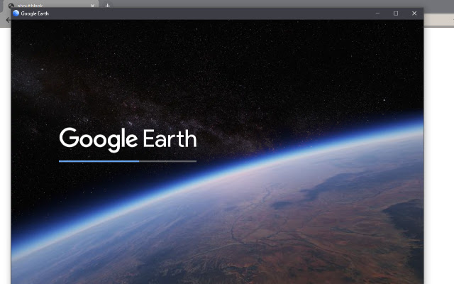
The first time you run Google Earth on your browser, you will see a brief overview of the details of this service. After that, the world will be under your control and you can use the mentioned service.
How to navigate in the version under the Google Earth browser
You may be a little surprised when you first run Google Earth on your browser.
To start, click the mouse on the globe and drag it to the other side to rotate. To tilt the view, hold down the Shift key on your system keyboard at the same time as clicking and rotating. Next, use the mouse wheel to zoom in or out. Additionally, you can use the “+” and “-” symbols at the bottom of the page to zoom in or out.
As you get closer to Earth, you will see the names of the countries. Clicking on the titles of the nations will open a box containing information about the location of that area, which you can also click to enlarge. This function is similar to when you click on a map of cities and places of interest to see more details.
Click the search icon on the left to explore a specific area. You can search for your location by location name, address, latitude and longitude, and more. In this case, you will most likely want to see the satellite view of your area.
Keyboard shortcuts for the Google Earth web version
Once you are a little familiar with Google Earth, you can use the keyboard shortcut keys to preview faster. Here are some of the most useful It’s service shortcuts on your browser.
- ? – Display a list of keyboard shortcuts
- / – Search
- Page Down and Page Up – Zoom in / out
- Arrow keys – Move the view
- Shift + Arrow Keys – Rotate the view
- O – Switch between 2D and 3D views
- R – Reset view
- Space key – stop moving
The best features of the version under the Google Earth browser
Google Earth offers many features and capabilities. In the following, we will mention some of the best and most practical features of this service.
- Have a virtual tour with Voyager
- Explore the world in three dimensions
- Project development
Have a virtual tour with Voyager
You can travel to virtual tours using the Voyager feature. Google refers to these tours as “map-based stories”; Which means that you can progress quickly by exploring places and discovering information about them.
Google Earth virtual tours include the Indian Railway and the history of volcanoes. The service also provides users with interactive quizzes that you can use to test their knowledge and information on topics such as animal relations and archeological sites.
Click the command icon on the left to access Voyager. This will open the voyeur cover so you can choose the tour you want
Explore the world in three dimensions(3D)
Although exploring our planet from a flat top view is enjoyable, with Google Earth you can go one step further and browse the world in 3D. You can see if this feature is enabled. To do this, click on the Map Style icon on the left and enable the Turn on 3D Buildings option. If you wish, you can also activate the attractive Turn on Animated Clouds feature in this section.
Of course, 3D exploration is not available in all parts of the world. This feature is only available in locations where Google has captured highly detailed images. Thus, it can be said that the 3D browsing capability of Google Earth is probably available in crowded areas or famous places of interest.
Hold the Shift key to see the 3D locations of your choice on the Earth, and to change the perspective angle, click the mouse and drag to the desired position.
If you want to quickly switch between 2D and 3D views, press the O key on your computer keyboard. Additionally switch between the two modes by clicking the 3D / 2D button at the bottom of the page.
Project construction
Projects are a way to gather places alongside text, photos, and video that can be used to create a custom map or story.
To get started, click on the Projects icon on the left side of the screen and click New> Create Project in Google Drive. In this step, click on Untitled Project and then enter your desired name for the project. Additionally, when creating a new project in Google Earth, you can provide a brief description of it.
In the next step, click on the New feature and then select one of the options Search to add place, Add placemark, Draw line or shape or Fullscreen slide. Feel free to review these features and see which ones are right for your project, and finally remove or add the desired feature.
How to change Google Earth settings
You can customize the service to suit your needs by changing your Google Earth settings. For example, animations can be optimized or units of measure can be changed.
Click the menu icon on the left to make the changes, then click Settings. Header-based Google Earth settings include Animations, Display Settings, Formats and Units, and General Settings.
If your computer is having trouble displaying Google Earth correctly, you should disable the Turn on fly animation and reduce the memory cache size.
Google automatically determines the format and units of your choice based on your location. However, you can manually adjust the units or change the latitude and longitude formatting as you wish.
If you want to return to the default state after making the changes, just click Reset to defaults at the bottom of the window.
How often is Google Earth updated?
You are now familiar with how to use the Google Earth service on your web browser. Now it’s time to explore different parts of the world. You may be surprised to learn that Google Earth is updated several times a day. To do this, you can easily look at the info bar at the bottom of the page to see when the satellite imagery was recorded. The more important a place is, the more chances it has for regular updates.