


A look at the top images of the international landscape photography competition
One Of The Most Interesting Photography Contests Of The Year Is The International Landscape Photography Contest.
Landscape photography, This contest has been held for more than five years and includes images of many of the most amazing landscapes worldwide.
The International Landscape Photographer of the Year competition has been held since 2014. The annual landscape photography competition has two parts: in one piece, single photos are contested, and in the other part, a collection of photos taken from a subject, which make a story of the issue.
In the global climate crisis era, when more than 40% of the world’s population has access to the Internet, there is often an attitude of “it’s happening somewhere else” regarding real-life environmental impacts. Most events happen in real-time in regional settings. Photographing and documenting what is happening in the past or present shows the importance of local environments.
Photography can present environmental issues to a broader audience; in a way that communicates with them more quickly than facts and figures. Probably, the effect of a photo of a cigarette pack left in nature is many times more than reading various articles on the destructive impact of litter on wildlife. Can you imagine thousands of migratory birds in flight? Photographs help us fully understand the proportions and complex natural phenomena; Therefore, one photo may have more impact than thousands of articles.
Everyday Climate Change is an Instagram feed of photographers worldwide that focuses on capturing visual evidence of climate change. In this feed, people not only share their images; Rather, they provide a suitable context for reducing harmful effects and even offer potential solutions.
You can help people who live far away from you compare their environment with the world around you. The images you capture with your camera and present to the world may be shocking to someone living on the other side. You never know, But the important thing is that wherever we live on this earth, we should not abandon our environment and care for it.
Therefore, photography of nature and landscapes is one of photography’s essential branches, highlighting the need to preserve and respect the environment.
Sometimes we humans must be reminded that our planet is incredible. In this context, the annual landscape photography competition winners are announced yearly to remind us that our world is fantastic. The winners of the fifth edition of the competition were selected from about 3,000 photos from 863 photographers. The photographer of the year based on at least four shots was Adam Gibbs from Canada.
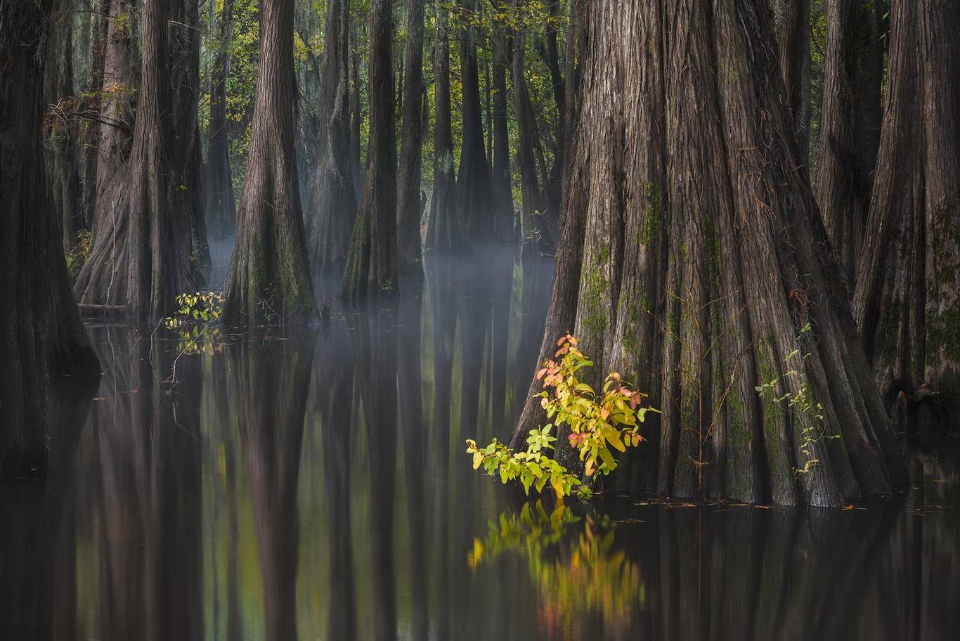
What makes someone the best landscape photographer? Perseverance? Experience? Luck? Love? In this article, you can see the best pictures of landscapes in 2018. The judges explained: “Looking at the selected works of Adam Gibbs, you can see the diversity of perspectives, the understanding of light, the skillful use of framing and composition. Adam’s work showcases a wide range of subjects from sandy deserts to icebergs and convinces us that he is the winner of Landscape Photographer of the Year.” Also, the winner of the single photo photographer of the year award is Paul Marsellini from America. Marceline is a master of Florida landscape photography, and his tree trunk art creates the visual illusion of a swamp and is wonderfully composed.
Appenzell
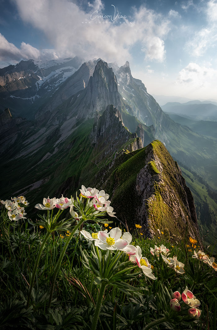
- Picture location name: Switzerland
- Name of the photographer: Simon Simon
Appenzell is located in the Appenzell department in the canton of Appenzell-Innrodander in Switzerland. This small town has a population of 5,500. Appenzell has no municipality, and parts of it are controlled by cities in other parts of the Appenzell Innerröder region, including Schöwende and Rutte. Appenzell, the capital of a semi-state, is nestled among rolling hills and beautiful scenery, and as it retains much of its old charm and beauty, it resembles a village more than a city. With its unspoiled nature and eye-catching hills, Appenzell is the ultimate in cleanliness, and its buildings, although old, look new.
Renfrew Port
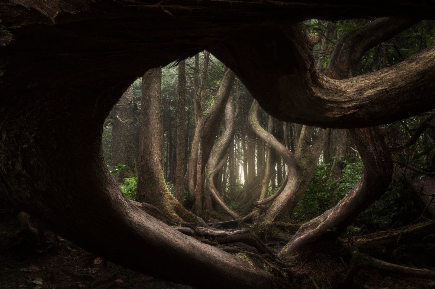
- Photo location: Vancouver Island, British Columbia, Canada
- Photographer’s name: Adam Gibbs
Port Renfrew is a small community located on the south shore of Port San Juan. According to the 2016 census, this small port has a population of 144 and is known as Canada’s “tall tree capital.” Renfrew Harbor has been home to Canada’s First Nations since ancient times. Originally called Port San Juan, the original settlers changed the name to honor Lord Renfrew, who planned to settle there. Like many coastal communities on Vancouver Island, Port Renfrew has a rich history of forestry and fishing.
Southeast coast of Australia
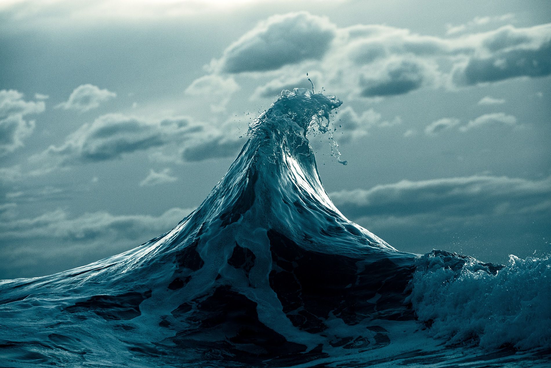
- Image location: Australia
- Photographer’s name: Warren Keelan
Australia is a continent surrounded by water and has more than eight thousand islands. Some of the islands are so big that they are compared to the size of Ireland. On the other hand, some other small stone islands are lost in the waters. Many islands of this continent are essential tourist destinations that attract visitors from all over the world. Australia is a country in the eastern part of the earth and the tiniest land in the world. This continent is geographically divided into different regions. It is surrounded by the waters of the Southern Arctic Ocean from the south, the Arafura Sea from the north, the Indian Ocean from the west, and the Pacific Ocean from the east. The east coast of Australia is directly connected to the Pacific Ocean, and sea winds influence the climate of this region.
Bromo Tengger Semeru National Park
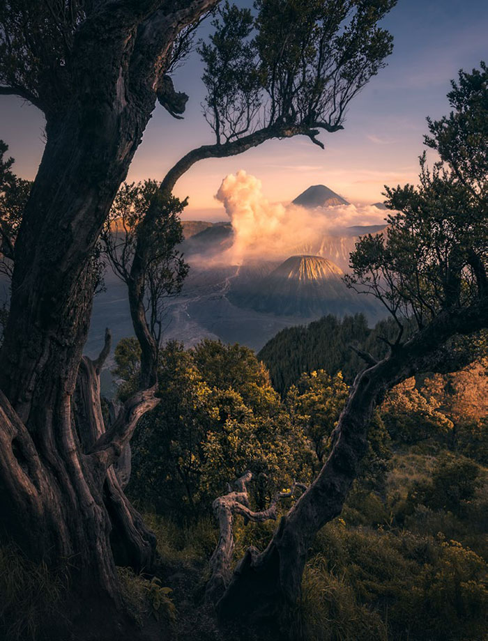
- Image location: Indonesia
- Photographer’s name: Weimin Chu
Bromo-Tenger Simro National Park is famous for its beautiful scenery of vast ancient volcanic craters and a group of beautiful volcanoes that emerged from it. The name of this park is taken from two mountains named Simro and Bromo and Tengar people who live in this area. It should be mentioned that Simro is the highest mountain in Java and one of Indonesia’s most active volcanoes. Mount Bromo lies in a sea of volcanic sand and is surrounded by large caldera boulders.
Somewhere between the towns of “Wynuka” and “Enid.”
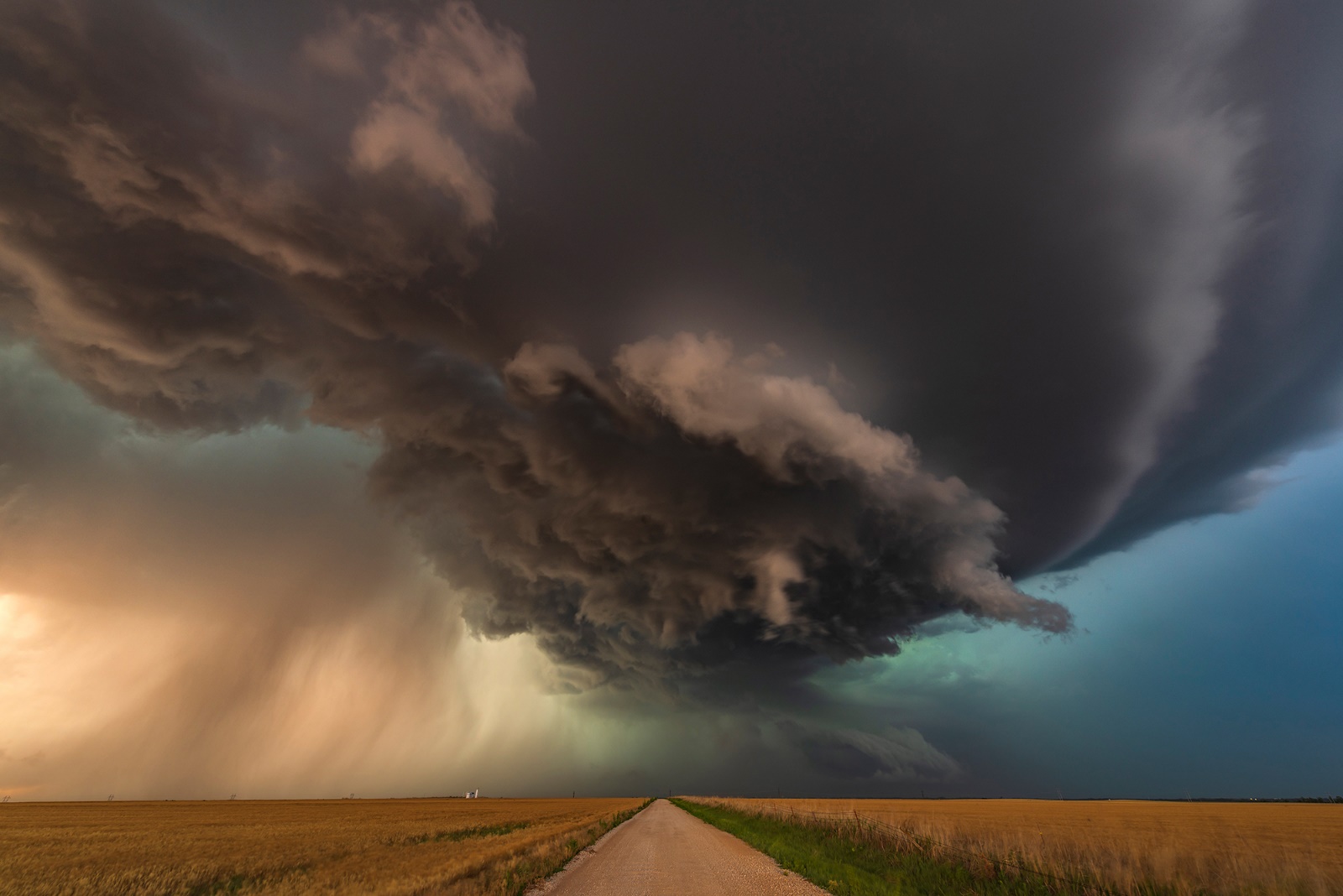
- Picture location: Oklahoma, USA
- Photographer’s name: John Feeney
Waynoka is a city in Woods County, Oklahoma, United States. This city is located seventy kilometers west of “Enid” city. This picture was recorded somewhere between these two cities.
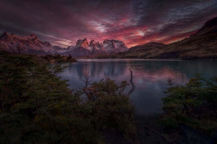
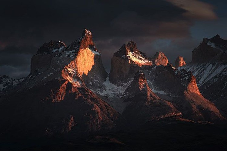
Torres Del Paine National Park
- Image location: Chile
- Photographer’s name: Weimin Chu
Torres del Paine National Park is a national park that includes mountains, glaciers, lakes, and rivers in southern Patagonia, Chile. Bernardo O’Higgins National Park borders this park to the west and Los Glaciares National Park to the north in Argentina. Pin means “blue” in the native Tehuelche language and is pronounced PIE-nay. Torres del Paine National Park is one of the world’s most beautiful national parks. Horse riding, sailing, and spending the night in the heart of the mountain are only part of the entertainment in this national park.
Nockberge Mountains
- Picture location: Austria
- Photographer’s name: Daniel Tripault
The Knock Mountains are the westernmost and highest mountain ranges of the Gorchtal Alps in Austria, extending across the federal states of Carinthia, Salzburg, and Styria. The appearance of these mountains is characterized by numerous dome-like peaks covered with grass.
Lofoten
- Image location: Norway
- Photographer’s name: Daniel Lan
Lofoten is a group of islands in the northern part of Norway and contains one of the most spectacular landscapes in Norway. The Lofoten archipelago is located above the Arctic Circle in turbulent waters and is known for its fishing, aurora borealis, midnight sun, and small fishing villages. The main attraction of this archipelago is its magical views. For example, you can stand by the shores of these islands and watch sea eagles and millions of other seabirds. Lofoten has famous beaches. Utakleiv beach was chosen as the most romantic beach in Europe in the Times poll. In this picture, Lofoten looks more beautiful with the aurora borealis.
Alabama Hills
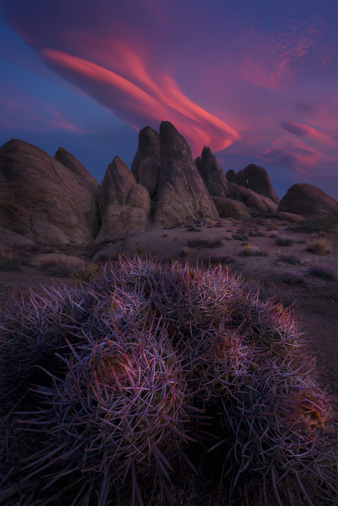
- Image location: California, United States
- Photographer: Miles Morgan
Not many tourists are aware of the fantastic rocky landscape of the Alabama Hills in western California. The Alabama Hills are a series of hills near the eastern slopes of the Sierra Nevada in the Owens Valley of California. In this place, you will find a pile of round and smooth rocks that are millions of years old. Wind and water erosion, combined with the abrasive effect of sand, has created strange shapes in the rocks.
Lapland (Lapland); Winner of the snow and ice category
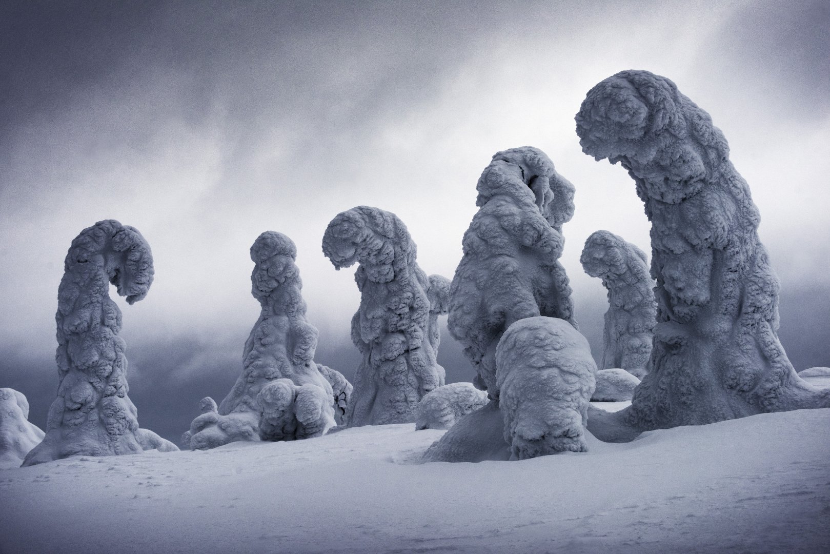
- Image location: Finland
- Photographer’s name: Ignacio Palacios
Lapland is the name of the region and cultural border in Northern Europe, most of which is located in the Arctic Circle. This region covers the northern parts of Norway, Sweden, and Finland and extends to the Kola Peninsula in Russia. Lapland is surrounded by the Norwegian Sea to the west, the Barnet Sea to the north, and the White Sea to the east. This region has been called Lapland or the land of the Lapps because of the people of northern Scandinavia known as the Rolapans or Lapps, who have lived there sporadically for several thousand years.
Among the symbols of this region are the beautiful reindeer that live in the dense pine forests of this region. The herds of these animals reach 200,000 packs. The Lappen tribes domesticated these deer and used their roots, meat, and skin. These animals are also responsible for pulling snow sleds. This exciting and mysterious area is known as the birthplace of Santa Claus in Finland. The village of Santa Claus or Santa Claus is also located in the arctic circle of Finnish Lapland. This area’s dense and beautiful pine forests are the source of most of Lapland’s timber. For this reason, this business group chose the name Lapland for its products and its symbol based on one of the essential elements related to this region, i.e., reindeer antlers.
Paria or Pahreah
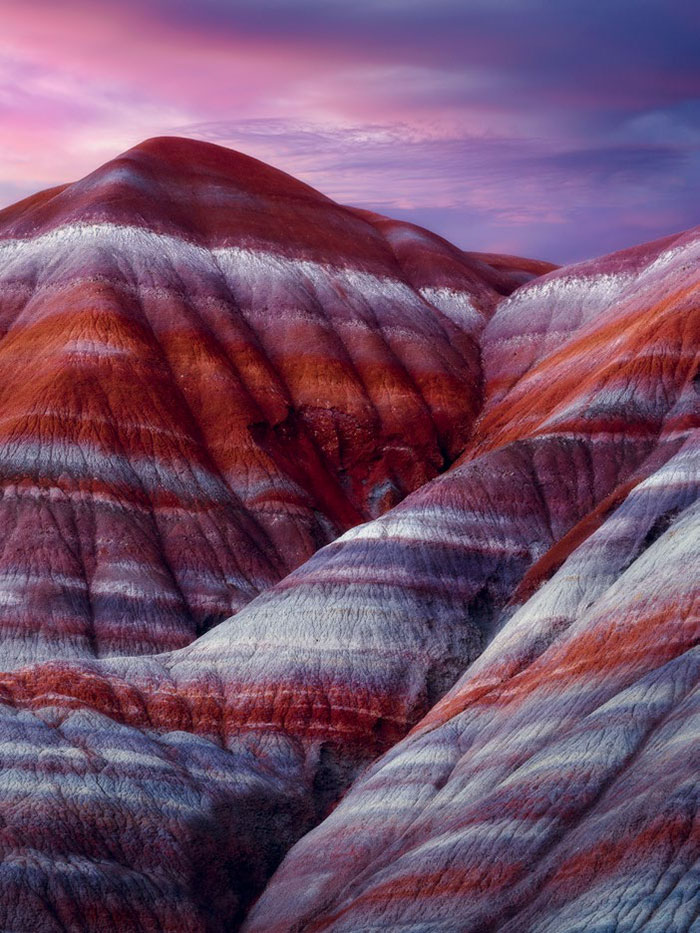
- Image location: Utah, USA
- Photographer name: Dylan Fox
Paria is a ghost town on the banks of the Paria River in Grand Staircase Escalante National Monument in central Kane County, Utah, in the United States. This city was inhabited from 1870 to 1929 and had residents; However, it has been used as a filming location since then.
White Mountain National Forest
- Image location: New Hampshire, United States
- Photographer’s name: Matt McPherson
The White Mountains National Forest is a federally managed forest located in the White Mountains of the northeastern United States. While often referred to casually as a park, it is a national forest used for hiking, camping, skiing, and other limited commercial purposes. This forest was established in 1918.
Bavarian Forest National Park (Bayerischer Wald)
- Picture location: Bavaria, Germany
- Photographer name: Lucas Wesley
The Bavarian Forest National Park is a national park in the Bavarian region and on the border of Germany and the Czech Republic. This park was opened on October 7, 1970, as the first German national park. The park consists of a large forest of spruce or pine trees, rugged mountain ranges, and several swamps. The Bavarian Forest National Park has 300 km for walking and 200 km for motorcycling, and visitors can thus identify different national park areas.
Gobi Desert
- Picture location: Mongolia
- Photographer’s name: Ignacio Palacios
The Gobi Desert has become famous due to the location of the Silk Road in it and the formation of a large part of the Mongol Empire. The Gobi Desert covers parts of southern Mongolia and northwestern China and includes steppe deserts and semi-desert plateaus. This desert is surrounded by the Altai mountains, the Teklemekan desert, and Tibetan Plateau. This desert is located above sea level, and its rainfall is up to 190 mm per year. Despite its unfavorable climate, freezing nights, and scorching days, the Gobi desert is home to many species of animals, such as two-humped camels. Some people also believe that the first dinosaur eggs were found in this place. Gobi desert has hot summers and cold winters. Although it is freezing in the Gobi desert, snow is rarely seen there.
South America (Southern US)
- Image location: South America
- Photographer’s name : Thorsten Schuerman
Oregon
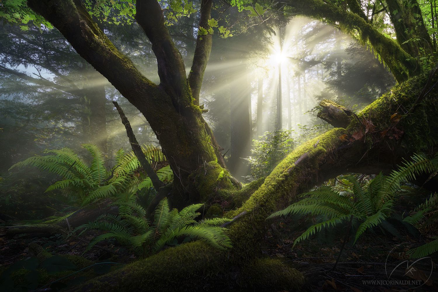
- Image location: United States
- Photographer name: Nico Rinaldi
Oregon, a state located in the northwest and on the coast of the Pacific Ocean, is famous for its lush green forests and beautiful beaches. The natural beauty of this state is a great attraction for tourists.
The winner of the 2018 landscape image
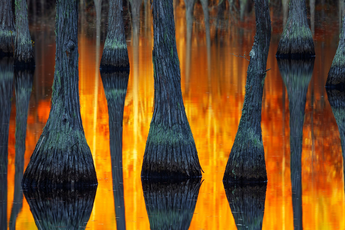
- Image Name: Southeast America
- Photographer’s name: Paul Marsellini
Sződliget
- Picture location: Hungary
- Photographer name: Gabor Dvornik
Südligt is a small town in the county of Post in Hungary, located in the Vats district. Sunlight has an area of 7.29 square kilometers and about 4,500 inhabitants. Agricultural lands surround this city on the east bank of the Danube. Südliget is a busy city connected to Budapest by train and road.
Sheffield, Tasmania
- Image location: Australia
- Photographer’s name: Mike Boynton
Sheffield is 23 kilometers from Davenport Land on the northwest coast of Tasmania. Sheffield has long been the rural hub of the Mount Rowland region. The Sheffield area is well known for its high-quality butter production from its dairy farms. This area is also suitable for lamb and beef production.
Mount Fitz Roy (Monte Fitz Roy); The winner of the sunrise and sunset section
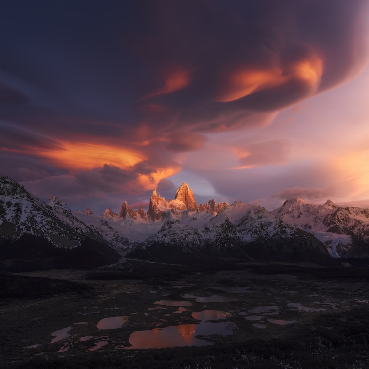
- Photo location: Patagonia, Argentina
- Photographer name: Xiao Zhu
Mount Fitz is a mountain south of the Patagonian Ice Region, located on the border of Argentina and Chile. The first ascent of it was made in 1952 by French mountaineer Lionel Troy and his fellow climber Guido Magnon. This mountain is among the most technical and challenging mountains for climbers. This mountain is also considered one of the most prominent peaks on the earth. The image of this mountain can also be seen in the logo of Patagonia clothing.
The Argentine explorer of this mountain, Francisco Moreno, first saw it on March 2, 1877. He named this mountain after the captain of HMS Beagle, Robert FitzRoy, FitzRoy. Robert Fitzroy was the one who traveled up the Santa Cruz River and mapped many parts of Patagonia. “Cerro,” which forms part of the name of this mountain, means high in Spanish, and “Chaltén” means smoking or smoky mountain, which refers to the fact that this peak is always hidden among the clouds.
San Antonio Pass
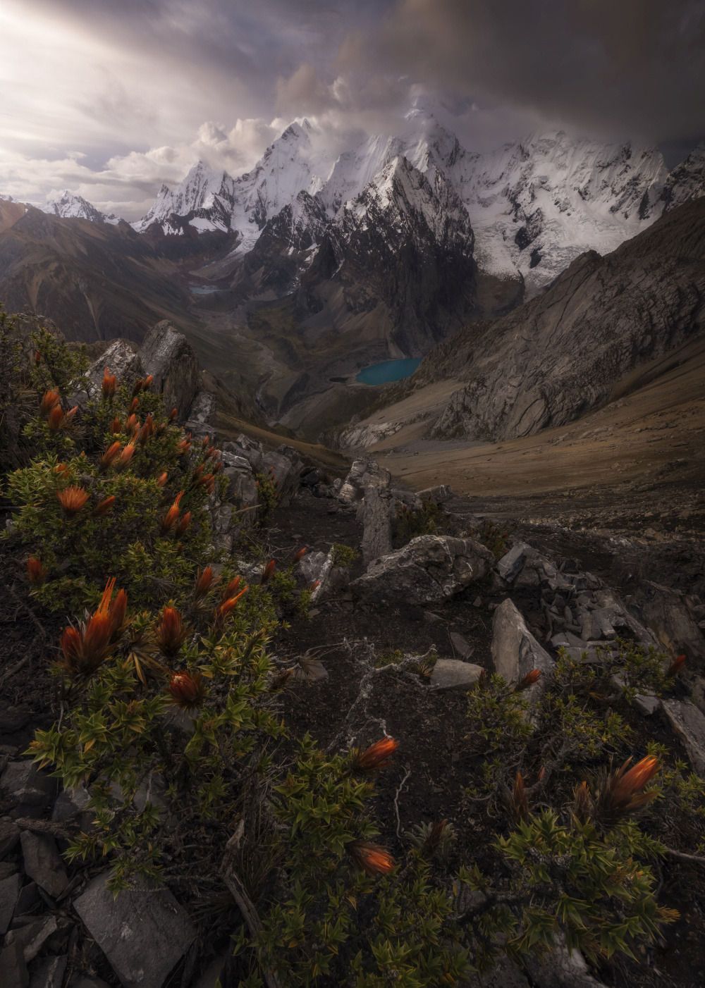
- Image location: Cordillera Huayosh, Peru
- Photographer’s name: Matt Jackish
Washougal
- Image location: Washington, USA
- Photographer: Miles Morgan
Washougal is a city in Clark County, Washington, with a population of 14,095 at the 2010 census.
Newhaven Harbor
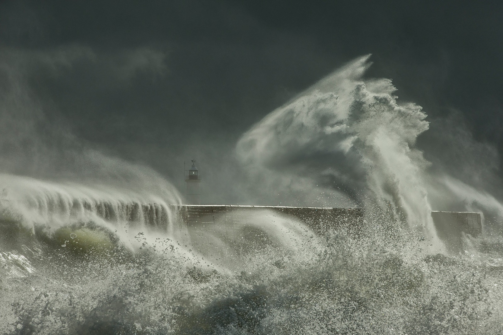
- Image location: East Sussex, England
- Photographer’s name: Edward Hyde
Southern Iceland
- Picture location: South Iceland
- Photographer name: Tommy Clark
Iceland, the northernmost land of Europe, is one of the island countries of the Atlantic Ocean. The city of Reykjavík is the capital of this country and has more than 320 thousand inhabitants. Iceland is one of the coldest regions in Europe and the world. The geographical conditions of Iceland have created and preserved pristine and stunning landscapes. In addition, Iceland is among the legendary and mysterious lands of history. Norse legends and mythology have always made this country and this land one of the most attractive places for tourists. Iceland’s historical richness, which Vikings are the main focus of, is one of these attractions. Iceland became independent from Denmark on December 1, 1918. Iceland, one of the poorest countries in the world until the 20th century, achieved prosperity in the years after World War II by industrializing fishing and receiving aid from the Marshall Plan and became one of the most prosperous countries in the world in the 1990s.
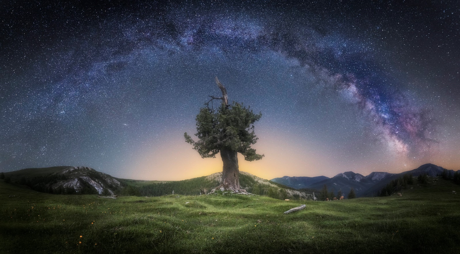
Oslo (Oslo); The winner of the tree photography category
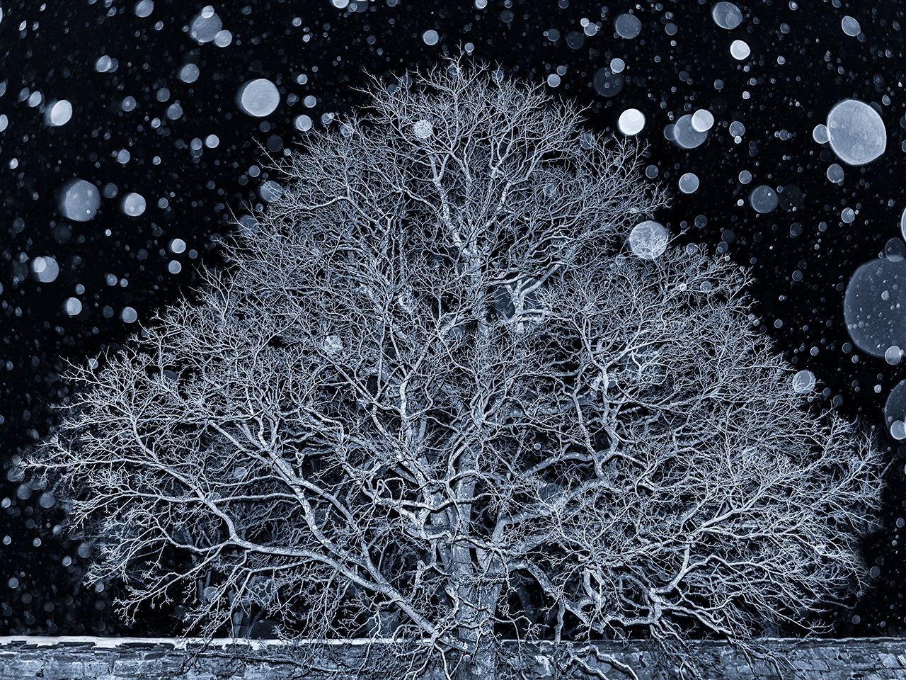
- Image location: Norway
- Photographer’s name: Ann Christine Lindas
Dolomites mountains
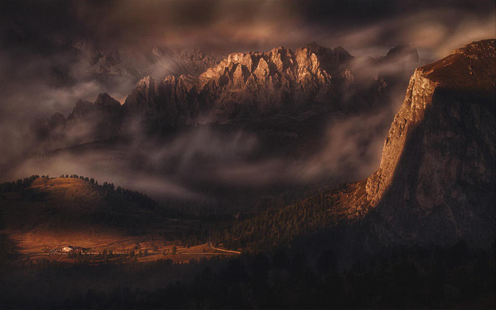
- Image location: Italy
- Photographer’s name: Peter Svoboda
The provinces of Belluno, South Tyrol, Pordenone, Trento, and Udine share a unique part of the Southern Alps called the Dolomites. It is called dolomite because of the type of rock in these mountains’ structures. The Dolomites are stunning. Their slopes are almost vertical, and the peaks are holding the sky. Due to the suitable conditions, these mountains are considered excellent skiing places.
The strange but beautiful Dolomite mountains, with their sharp shapes, vertical columns, natural glaciers, alpine meadows, and clear mountain lakes, are gorgeous and eye-catching in every season. Le Corbusier, the famous French architect, called the Dolomite Alps “the greatest natural architecture in the world.” UNESCO experts agree with him;n 2009, this area was declared a world heritage based on criteria VII and VIII. The first criterion means that the site has excellent natural phenomena with beautiful and unique natural areas, and the second means respecting historical monuments and outstanding examples representing the earth’s history.
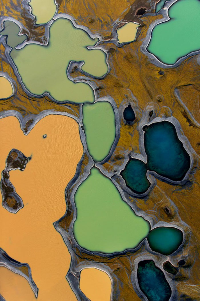
Veadeiros Tablelands National Park
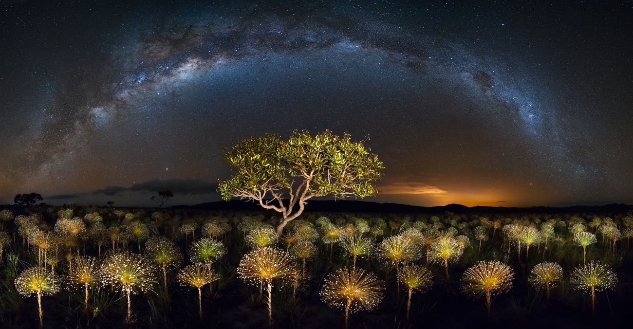
- Image location: Brazil
- Photographer’s name: Marcio Estevez Cabral

- Image location: unknown
- Photographer’s name: Peter Svoboda
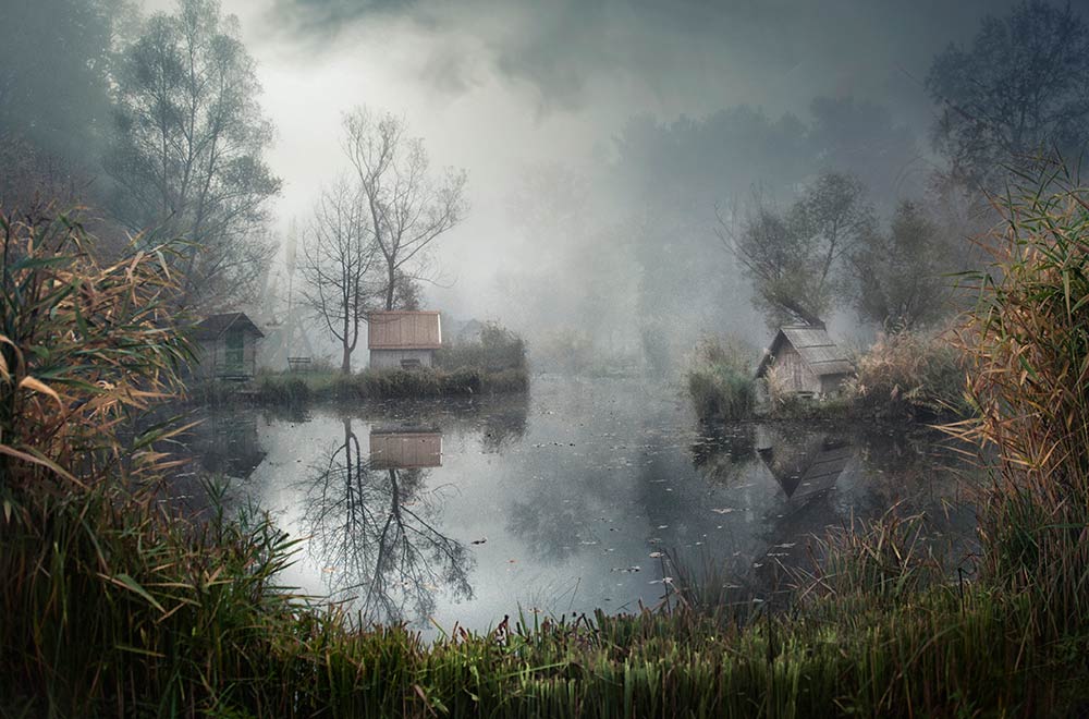
Louisiana (Atchafalaya Basin, Louisiana)

- Image location: United States
- Name of the photographer: Roberto Marchegiani
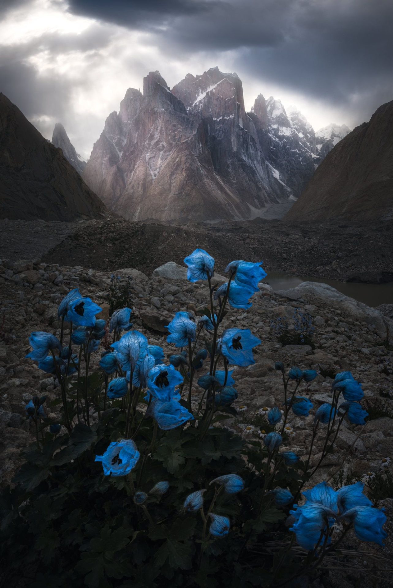
Trango Towers
- Picture location: North Pakistan
- Photographer’s name: Weimin Chu
The Tarango Mountains are a series of tower-like rocks and mountains located in the Gilgit-Baltistan province in northern Pakistan. Every year, many climbers and rock climbers worldwide travel to this area. These mountains are a subset of the Karaqom mountain range, and the highest point of these rocks is 6286 meters. The type of rock in these mountains is Seng Khara. Trango Mountains are the highest cliffs in the world.